Shop our historical maps
News
Carta Marina in special edition - now bigger than ever

24
Oct
Oct
Now you can buy the classic old map Carta Marina from the 16th century in large format, the whole ~120×175 cm.
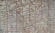
The Carta Marina is the earliest reasonably accurate map of the Nordic and Baltic countries. The map's author, Olaus Magnus (1490-1557), brother of Sweden's last Catholic Archbishop Johannes Magnus, spent twelve years working on the map before it was printed in Venice in 1539.
Map of 70×100 cm that you have long been able to buy from Allmogens is the second edition of the map published by Antonio Lafreri in 1572, then coloured by hand during the same period. In the second edition, Antonio started from Olaus Magnus' original, which was 125×170 cm, and redrew all the details from scratch to make the map more suitable for smaller formats. Now this edition is being published in a new, larger size which is close to the original size, about 120×175 cm.
Every penny from the sale of this special edition will go towards upgrading Allmogens video equipment for 2020. Time to scrap the 8 year old camera, now let's step into a higher league so that there will be many more videos produced faster, better and with higher quality.
Buy the special edition here.
Subscribe to YouTube:
If you appreciate Allmogens independent work to portray our fine Swedish history and Nordic culture, you are welcome to buy something nice in the shop or support us with a voluntary donation. Thank you in advance!
Support Allmogens via Swish: 123 258 97 29
Support Allmogens by becoming a member
Support Allmogens in your will